 256.778.1588
 contact@3.0websitedesigns.com
256.778.1588
contact@3.0websitedesigns.com
contact@3.0websitedesigns.com
256.778.1588
contact@3.0websitedesigns.com
National Interactive Radar Map.
 AWESOME RADAR
The national Interactive Radar map uses NEXRAD data provided by the Iowa Environmental Mesonet (IEM) through a live web map service. Our goal is to make this national radar data available in a user friendly interactive web map so you can view your local weather quickly.
EZ weather Radar has just added a forecast feature that can be found in the menu. This feature allows you to get the weather forecast either by your current location or by zipcode, city, address, or place name. Try it out now by clicking Forecast
 HIGH EFFICIENCY
NEXRAD Weather data is very important in identifying local weather patterns and current conditions. We are currently displaying the Radar data known as Digital Base Reflectivity (NOQ) derived from algorithms including Spectrum Width, Vertically Integrated Liquid, and the Velocity Azimuth Display (VAD) Wind Profile.
EZ weather Radar was created because there is some outstanding national weather radar data available throughout the United States that we wanted to display in a user friendly format. We believe that our national interactive radar map (EZ weather Radar) makes it clear and easy to identify what is going on not only in your local area, but also any place you choose to zoom to in the States. We do not have a lot of bells and whistles on our map because we want it to be easy to use and not cluttered with needless knobs. We may choose to add a few in the future as we get feedback, however our overall goal is to keep it simple!
Currently we are displaying NEXRAD Base Reflectivity which gives a pretty clear view of the current weather events including rain, mix, ice, and snow. The weather radar data is produced every five minutes so we automatically update the map for you as the data is released. NEXRAD or Nexrad (Next-Generation Radar) is a network of 158 high-resolution Doppler weather radars operated by the National Weather Service, an agency of the National Oceanic and Atmospheric Administration (NOAA) within the United States Department of Commerce. Its technical name is WSR-88D, which stands for Weather Surveillance Radar, 1988, Doppler. Along with the radar weather data we have added the International Space Station on the map so that you may follow it to see where it is at any particular time. The location updates every 5 seconds so you can see how fast it actually navigates around the globe.
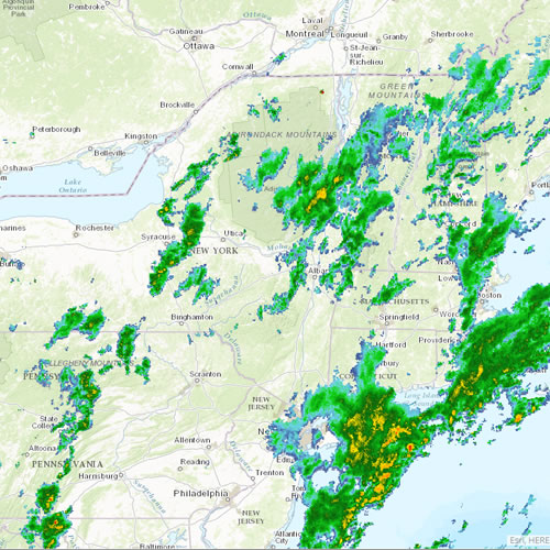
North East
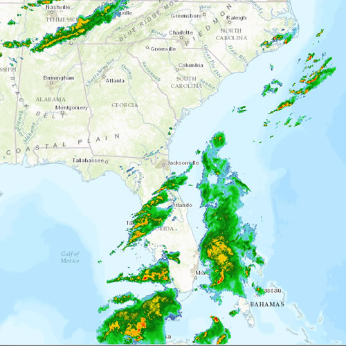
South East
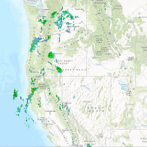
North West

South West
Above are some quick links to the different local regions that you might want to get data from. Feel free to use the seach button on the map to get to your location quicker or simply zoom the national weather map into the local area to see the local weather data.
3.0 Website Designs
 2407 Belltown Dr. SW Huntsville AL 35803
 256.778.1588


